Although the tourism potential is very high, Igdir is one of our eastern provinces, which seeks promotional support, due to insufficient tourism facilities, the failure to preserve historical-cultural values sufficiently and may be due to the lack of awareness.
Igdir via Yan
The easiest way to reach Igdir is to travel to Kars airport. However, due to repairs and modifications, our aircraft lands at Van with transfer at Ankara. At the airport, we were met by Murat Aktuna, the Primary Education Inspector of the Ministry of National Education and Bayram Arslan, the personal driver of Governor of Igdir. After a short time, we depart for Igdir through Tendurek.
Impressions from Tendurek
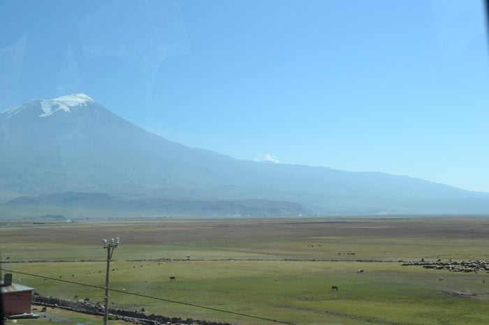
Tendurek is the highest peak of thc Tendurek volcanic cone, located between Dogu Beyazit and Caldiran. There is a lake with a diameter of 400-500 meters in the eastern crater of the mountain, which tolals 3,298 meters. The surface of Tendurek, formed of volcanic rocks, seems to provide easy passage at a glance, it is formed by caves and in here even a distance of 100 meters can be traveled in 1-2 hours. Behind the ridges of the hills, facing Turkey, there is Iran. We are very close to the border. When we pass from Tendurek control point, we see that there is stili snow on the peaks of the hills, which are located at the end of the flat green meadows in the right and left of the road. These meadows are surrounded with volcanic rock. It is possible to see sheep and goat herds everywhere, because husbandry is one of the most important means of making a living for thc local people.
The first meeting with Agri Mountain. We will arrive at Igdir within half hour. Agri Mountain is seen on the horizon.
Now Agri Mountain always follows us, regardless of our direction, whether left or right. Its small sister, Kucuk Agri is more visible. They are still covered by snow.
The clouds shade these two mountains and this view resembles a water pond and even a mountain pond. As we have seen in its photographs, the peak of Buyuk Agri is hiding behind the mist. The mountains are located in the south of the province of Igdir and 15 kilometers of Northeast of Dogubeyazit. Agri Mountain, with an altitude difference of 4,000 meters with the Igdir plain, is deemed as the highest peak of Turkey and Europe. Northern route climbs, chosen by the professional climbers, are made in the side of Kup Lake in Igdir. It is also believed that Buyuk Agri, which is the second biggest volcanic mountain in the worId, also hosted the Noah’s Ark. We suddenly remember that Photographer Ara Guler had photographed remains, believed to be of Noah’s Ark. While we continue on our route, escorted by Agri Mountain, we think that we had to visit the border gates to understand Igdir better.
Read More about Scientific History of Istanbul
